
3D EXCAVATOR CONTROL
3D navigation consisting of sensors, receiver, antennas, ToughPad and software, enabling the operator to guide the excavator along a digital terrain model. High-quality correction data and connectivity to a sufficient number of satellites, allows accuracy in the 1-3 cm range.
MTS-NAVI
POSITIONING SYSTEM COMPONENTS WITH AN ACCURACY OF 1 M
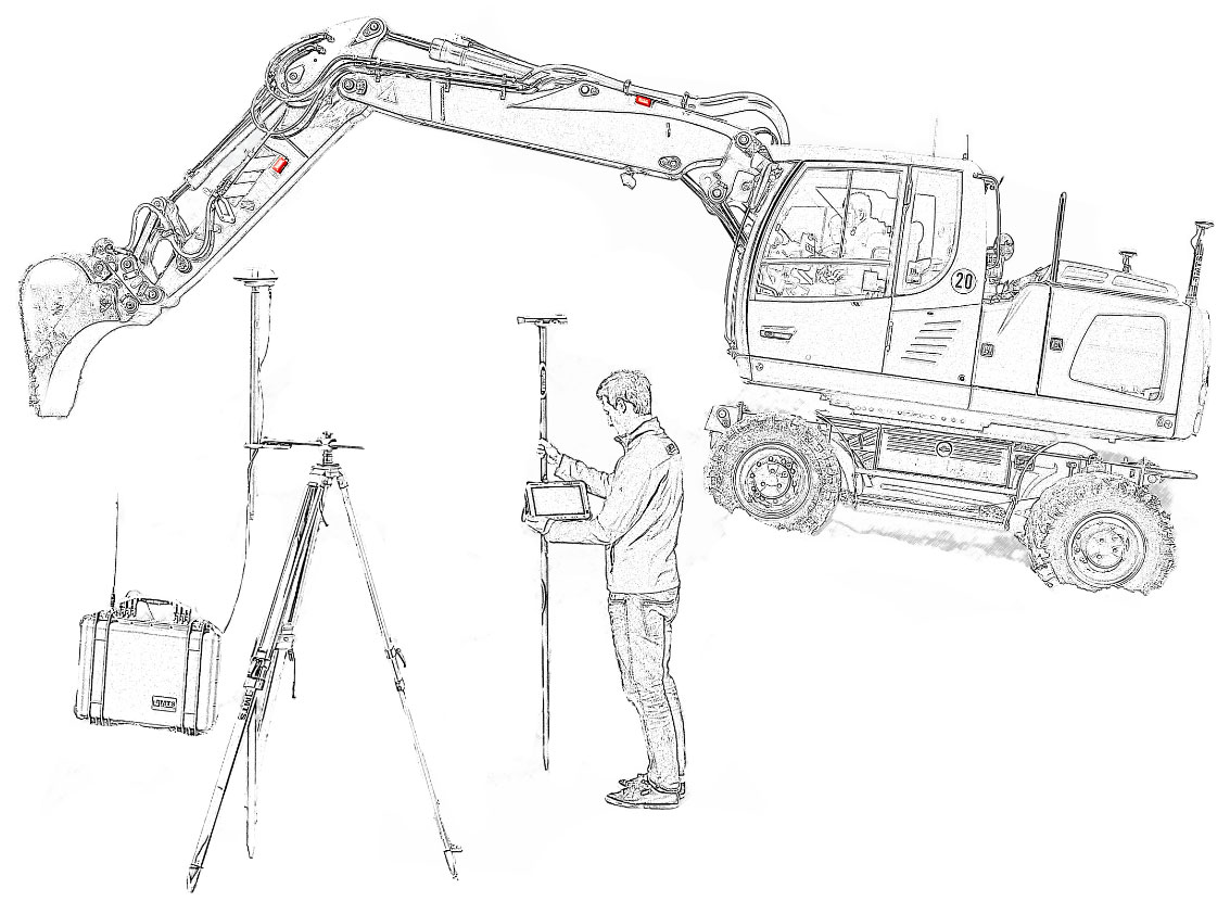
TILT SENSORS
Determines the position of the excavator bucket
BASIC RADIO COMMUNICATIONS
Transmission of correction data
TOUGHPAD
As a Rover field survey module and excavator calculator
SATELLITE ANTENNAS
Position and rotation
RECEIVER
Calculates the position of the excavator
RADIO COMMUNICATIONS
Correction data transmitted via internet
CORRECTION DATA FOR EXCAVATOR/ROVER OFF-ROAD MODULE
For short building works
RADIO COMMUNICATION
For longer building works
BASE RADIO COMMUNICATION
An integrated mobile communications modem allows reception of correction data sent by the surveying authority or other sources. This eliminates the need for a base station.
The use of the base station allows the use of more Rover excavators and field survey modules. The base station is compatible with base stations from other manufacturers.
ADVANTAGE: NO INVESTMENT IN A BASE STATION
ADVANTAGE: NO RUNNING COSTS
FULL COMPATIBILITY WITH MIXED FLEETS
MTS’s machine radio communication modems are compatible with all typical machine control systems, Rover field survey modules and base station receivers. The MTS-LOC module reads calibration data from Trimble field modules, SurvPC computers and FAST Survey. Construction site technology data for the Rover field survey module and excavator, is compatible with third-party equipment. MTS currently uses the popular DXF and LandXML formats. In future, the IFC format will be used.
This means that data preparation will be performed for all systems only once.
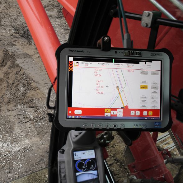
THE HEART OF THE SYSTEM:
MTS-NAVI
The MTS-Navi navigation unit, allows the machine operator to guide the excavator bucket along a digital terrain model using satellite signals and inclination sensors. By compensating for the current set position and the actual position of the excavator bucket, the machine can determine precise information regarding the work to be carried out. This avoids tedious survey work and time-consuming and costly corrections to the ground profile.
SPECIAL SOLUTIONS
The MTS-NAVI system, can be used to control a special excavator with an additional boom or additional equipment.
EXAMPLES OF APPLICATION:
MAKING DUCTS AND LAYING PIPES:
During digging, the system indicates the position of the pipes running through the working area. The bottom of the trench can be suitably profiled in the first working step, guaranteeing stable and even pipe embedment.
WATER CONSTRUCTION:
The 3D control of the excavator bucket, allows precise control of the bucket in conditions of even complete lack of visibility. The position and orientation of the bucket under water is displayed on the screen. The resulting excavation depth is logged.
UNDERGROUND AND ROAD CONSTRUCTION:
Excavate without piling and eliminate the associated downtime by presenting all obstacles directly on the machine’s screen.
FEATURES AND EQUIPMENT
MORE THAN JUST THE CONTROL OF AN EXCAVATOR
MORE THAN JUST CONTROL OF AN EXCAVATOR
Our ToughPad can be used not only as a tablet in an excavator, but also as a rover field survey module and office computer.
SIMPLE MEASURING FUNCTION
The position of elements such as piles, hole markers and house connection clamps can be determined automatically.
OPTION TO PRINT OUT MEASUREMENTS
The measurement data can be saved in PDF or DXF format and then printed out. It is also possible to send them by e-mail so that the measurements are immediately available in the construction office.
REMOTE DIAGNOSTICS MODULE AND SERVICE HOTLINE
If you have any questions, our service is able to get an idea of the situation within seconds via the remote diagnostics function.